Žádné produkty
Kategorie
-
Knihy
- 17., 18. a 19. století - Bohemika, Moravika
- 17., 18. a 19. století - literatura, ilustrované atd. - zahr.
- 20. stol. - literatura, poezie, bibliofilie, ilustrované atd. - české
- 20. stol. - literatura, poezie, bibliofilie, ilustrované atd. - zahr.
- Dějiny kultury, varia
- Dětské a dobrodružné knihy
- Filozofie, teologie, pedagogika, ekonomie, sociologie
- Historie a právo
- Místopis, cestopisy a geografie
- Příroda a přírodní vědy
- Staré tisky (15. a 16. století)
- Výtvarné umění a architektura
-
Kresby a grafika
-
České moderní umění (grafické listy, ex-libris, kresby)
- Bílek, František (1872-1941)
- Bouda, Cyril (1901-1984)
- Hodek, Josef mladší (1888-1973)
- Holler, Josef (1903-1982)
- Kobliha, František (1877-1962)
- Konůpek, Jan (1883-1950)
- Obrátil, Karel Jaroslav
- Seydl, Zdenek (1916-1978)
- Šimon, Tavík František (1877-1942)
- Stretti, Viktor (1878-1957)
- Švabinský, Max (1873-1962)
- Váchal, Josef (1884-1969)
- Vondrouš, Jan Charles (1884-1970)
- Evropské moderní umění (grafické listy, ex-libris, kresby)
- Grafika starých mistrů
- Japonské dřevoryty
- Staré rytiny, kresby a dekorativní grafika
-
České moderní umění (grafické listy, ex-libris, kresby)
-
Staré mapy a veduty
- Afrika
- Amerika
- Asie a Austrálie
- Atlasy
-
Evropa
-
Belgie, Nizozemsko, Lucembursko
- Amsterdam
- Antverpy
- Belgie a Lucembursko
- Bergen op Zoom
- Blokzijl
- Bommenede
- Brabant
- Bruggy
- Brusel
- Charleroi
- Delft
- Dinant
- Dordrecht
- Elburg
- Flandry
- Fort Rammekens
- Friesland
- Friesland a Groningen
- Gelderland
- Geraardsbergen
- Grave
- Groningen
- Haag
- Hainaut
- Harderwijk
- Harlingen
- Holland
- Hulst
- Huy
- Kortrijk
- Leuven
- Lier
- Limbourg
- Limburg
- Lucembursko
- Lutych
- Maastricht
- Mechelen
- Middelburg
- Mons
- Namur
- Nijmegen
- Nizozemí
- Nizozemí a Belgie
- Ostende
- Overijssel
- Rotterdam
- Spa
- Stavoren
- Tiel
- Utrecht
- Veere
- Veurne
- Zeeland
- Zieriksee
- Zierikzee
- Zutphen
- Zype
-
Čechy, Morava a Slezsko
- Bedřichov
- Beroun
- Brandýs nad Labem
- Branná (okr. Šumperk)
- Břeclav
- Březnice
- Brno
- Brodce (okr. Mladá Boleslav)
- Čáslav
- Čechy
- Čelákovice
- České Budějovice
- Český Brod
- Český Šternberk
- Cheb
- Chomutov
- Děčín
- Dolní Olešnice - Nové Zámky
- Dvůr Králové nad Labem
- Františkovy Lázně
- Frýdlant
- Hostinné
- Hradec Králové
- Hřensko
- Jaroměř
- Jižní Čechy
- Kamýk u Litoměřic
- Karlovy Vary
- Kasejovice - Řesanice
- Kolín
- Kostelec nad Labem
- Křivoklát
- Krkonoše
- Kuks
- Kunětická Hora
- Kutná Hora
- Libochovany
- Litoměřice
- Loket
- Louny
- Lovosice
- Lysá nad Labem
- Mariánské Lázně
- Mělník
- Mladoboleslavsko
- Morava
- Most
- Náchod
- Nymburk
- Olomouc
- Olomoucko
- Ostrov nad Ohří
- Pardubice
- Plzeň
- Poděbrady
- Polná
- Prácheňsko
- Praha
- Praha - Cheb
- Přelouč
- Rabí
- Rakovnicko
- Rakovník
- Roudnice nad Labem
- Rožmberk
- Rožnov pod Radhoštěm
- Sedlec
- Smiřice
- Štětí
- Střekov
- Šumava
- Tábor
- Teplice
- Terezín
- Třeboň
- Týnec nad Labem
- Uničov
- Ústí nad Labem
- Vinec
- Vltava
- Vrabinec
- Vrchlabí
- Vyšší Brod
- Zákupy
- Žampach (zámek)
- Žireč
- Žleby
- Znojemsko a Jihlavsko
- Znojmo
- Zvíkov
- Dunaj
- Evropa (kontinent)
-
Francie
- Albi
- Alsasko
- Anjou
- Artois
- Bar-le-Duc
- Berry
- Blois
- Bourbourg
- Bresse
- Burgundsko-Franche-Comté
- Cambrai
- Cassel
- Château de Lichtenberg
- Chaumont
- Compiegne a Noyon
- Dauphine
- Gaskoňsko
- Gastinais a Senonais
- Gravelines
- Hauts-de-France
- Ile de France
- Korsika
- La Bassée - Hesdin
- Languedoc
- Lille
- Limoges
- Lotrinsko
- Lyon
- Maine
- Marseille
- Mety
- Montmélian
- Mylhúzy
- Nancy
- Nice
- Normandie
- Paříž
- Perche
- Pikardie
- Poitou
- Provence
- Quercy
- Ré a Oléron
- Remeš - Rethel
- Saint-Omer
- Saintonge a Aunis
- Savojsko
- Štrasburk
- Tarn (departement)
- Vexin
-
Itálie
- Abruzzo
- Ancona
- Apulie (Puglia)
- Arcevia
- Bari a Basilicata
- Belluno a Feltre
- Benátky
- Bergamo
- Bologna
- Brescia
- Brescia a Crema
- Cadore
- Cagliari
- Caiazzo
- Capitanata
- Carmagnola
- Catania
- Civitavecchia
- Crema
- Cremona
- Cuneo
- Elba
- Emilia Romagna
- Faenza
- Fano
- Ferrara
- Florencie
- Fondi
- Friuli
- Gaeta
- Gallipoli
- Ischia
- Itálie
- Janov
- Jižní Itálie
- Kalábrie
- Kampánie
- Lazio
- Lerici
- Ligurie (Italská Riviéra)
- Livorno
- Lombardie
- Loreto
- Lucca
- Mantova
- Mantua
- Marche (Ancona)
- Merano
- Messina
- Milán
- Mirandola
- Modena
- Molise
- Monferrato
- Neapol
- Netuno
- Nocera Umbra
- Orvieto
- Orvieto a Loreto
- Otranto
- Pád
- Padova
- Palermo
- Parma
- Pavia
- Perugia
- Pesaro
- Piacenza
- Piemont
- Pinerolo
- Piombino
- Pisa
- Pozzuoli
- Reggio di Calabria
- Reggio Emilia
- Řím
- Rimini
- Rovigo
- San Marino
- Sardinie
- Severní Itálie
- Sicílie
- Sicílie a Malta
- Sicílie a Sardinie
- Siena
- Spoleto
- Střední Itálie
- Sulmona
- Taranto
- Terracina
- Tivoli
- Tortona
- Toskánsko
- Trapani
- Trentino-Alto Adige / Südtirol
- Trento
- Treviso
- Tricarico
- Turín
- Tyrolsko
- Udine
- Umbria
- Urbino
- Velletri
- Vercelli
- Verona
- Vicenza
- Viterbo
- Labe
- Monako
- Německo
- Polsko, Slezsko, Rusko, Pobaltí
- Rakousko
- Řecko, Středomoří
- Rýn
- Severní Evropa
- Skandinávie a Island
- Španělsko a Portugalsko
- Střední Evropa
- Středozemní moře
- Švýcarsko
-
Velká Británie a Irsko
- Anglie
- Bedford a Buckinghamshire
- Berkshire a Hampshire
- Cambridgeshire
- Cornwall
- Cumberland
- Denbigh a Flint
- Derbyshire
- Devon
- Dorset
- Durham (hrabství)
- Essex
- Gloucestershire
- Hereford
- Hertfordshire
- Hertfordshire and Middlesex
- Huntingdonshire
- Irsko
- Isle of Man
- Isle of Wight
- Jihovýchodní Anglie
- Jihozápadní Anglie
- Kent
- Leicestershire
- Lincolnshire
- Londýn
- Norfolk
- Northampton
- Northumberland
- Nottinghamshire
- Oxfordshire
- Severní Anglie
- Severovýchodní Anglie
- Severozápadní Anglie
- Shropshire a Staffordshire
- Skotsko
- Somerset
- Staffordshire
- Surrey
- Sussex
- Velká Británie a Irsko
- Wales
- Westmorland
- Wiltshire
- Worcestershire a Warwickshire
- Východní a jihovýchodní Evropa, Balkán
-
Belgie, Nizozemsko, Lucembursko
- Ostrovy (zvláštní katalog)
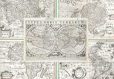
- Svět, oceány, póly a hvězdné mapy
- Varia
-
Reynek, Bohuslav - Renaud, Suzanne Paprsek mezi mrakyKatalog. číslo: 21626
Reynek, Bohuslav a Renaud, Suzanne. "Paprsek mezi mraky". Praha: Antikvariát Křenek, 2017. Velká 8°. 70, (2) str. OBrož. s il. obálkou.
150,00 KčK prodeji -
(Brno) Burg Novyhrad. Die Meidenburg bei...Katalog. číslo: 25577
Brno a okolí. "Burg Novyhrad. ... Der Spilberg. Die Domkirche in Brünn. ... Die Hansenburg bei Eisgrub. Wasserkunst in Eisgrub". Pův. ocelorytina. Lloyd, Terst, ca. 1850. List na památku - 9 pohledů v ornamentální borduře. 16,5:27 cm.
1 500,00 KčK prodeji -
Kupka, František Album Frant. KupkyKatalog. číslo: 25564
(František Kupka). "Album Frant. Kupky". Praha: Kočí, ca. 1905. Fol. Dvoulist s úvodní studií K. E. Schmidta a seznamem vyobrazení, 29 listů křídového papíru s 33 reprodukcemi. Volné listy v pův. il. pap. obálce.
7 500,00 KčK prodeji -
Poppel, Johann (autor) Lange, Ludwig (další autoři ) Prag von der NordseiteKatalog. číslo: 25355
Praha od severu. "Prag von der Nordseite". Pův. ocelorytina. Podle G. Langeovy kresby ryl J. Poppel. Vyd. G. G. Lange v Darmstadtu, 1841. S německým titulem pod obrázkem. 10:15 cm (obrázek).
2 800,00 KčK prodeji -
Poppel, Johann (autor) Lange, Ludwig (další autoři ) Die St. Veitskirche in PragKatalog. číslo: 25569
Praha. Chrám sv. Víta. "Die St. Veitskirche in Prag". Původní ocelorytina. Podle L. Langeho kresby ryl J. Poppel. Vyd. G. G. Lange v Darmstadtu, 1842. S figurami a koňmi v popředí a něm. titulem pod obrázkem. 15:11 cm (obrázek).
2 400,00 KčK prodeji -
Schwenter, Daniel (autor) Böckler, Georg Andreas (další autor) Geometriae Practicae Novae et Auctae Libri...Katalog. číslo: 25566
Schwenter, Daniel (1585-1636) a Böckler, Georg Andreas (1617-1687). "Geometriae Practicae Novae et Auctae Libri VI.". Norimberk: J. A. Endter, 1667. Menší 4°. Rytý titul, (54), 820 (spr. 816) str. s množstvím dřevořez. ilustrací, slož. mědiryt. tabule za str. 322. Dobová celokož vazba.
40 000,00 KčK prodeji -
Alexandre, Dom Jacques Ausführliche Abhandlung Von Den Uhren...Katalog. číslo: 25544
Alexandre, Jacques (1653-1734). "Ausführliche Abhandlung Von Den Uhren überhaupt". Lemgo: J. H. Meyer, 1738. 8°. (26), 408, (16) str., XXV (správně XXVII) slož. mědirytinových tabulí. Dobová polokožená vazba.
15 000,00 KčK prodeji -
Váchal, Josef Ex libris Máňa PřibilováKatalog. číslo: 25537
Váchal, Josef. "Ex libris Máňa Přibilová" (Krajinka). Původní dřevoryt, 1911. 3,3:3,5 cm.
120,00 KčK prodeji

 Burg Novyhrad. Die Meidenburg bei Polau. Ruine Boskowitz")


-
Kontakty
Máte-li jakékoli dotazy, kontaktujte nás prosím
-
Obchodní podmínky
Ceny, dodání a doprava, podmínky prodeje. Vše naleznete v sekci obchodní podmínky
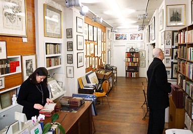
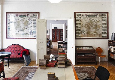
 Antikvariát Křenek
Mimo krásných, starých či vzácných knih nabízíme rozsáhlou kolekci starých map, dekorativní grafiky (i plakátů) a rytin, která uspokojuje vedle sběratelů i dekoratéry interiérů. Prodáváme pouze originály ze 16.–20. stol., na přání paspartujeme a rámujeme.